|
Friday, September 02, 2005
google earth...
ok this is old technology... but kinda new to me still, since my laptop is prehistoric...
i was playing ard with google maps a few months back in office... was pretty impressed by how they have satellite photos covering the whole of united states (and canada). they even can calculate like the best route from one place to the next, and show where taxis are located....
for example...
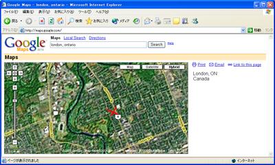
the red x marks the spot where i lived when i was in canada for exchange (1037 richmond street, london, ontario) the big patch of land on the upper left is the university of western ontario, where i attended...
it doesnt look very cool because, well they have very good close up images for american cities, but for small cities like this in canada, that's the most zoomed up pic available... ah well... still fun nevertheless...
but anyways, when i was referring to "old technology", i wasnt referring to this google maps... i was referring to google earth... (before i forget, they have katrina pics now! can see the satellite pics using this)
well i did know about this little program quite sometime back, but looking at this
Minimum configuration:
Operating system: Windows 2000, Windows XP
CPU speed: Intel® Pentium® PIII 500 MHz
System memory (RAM): 128MB
200MB hard-disk space
3D graphics card: 3D-capable video card with 16MB VRAM
1024x768, 32-bit true color screen
Network speed: 128 kbps ("Broadband/Cable Internet")
well that's pushing my prehistoric machine to the limit (and it still wont make it - barely)... hell, i even have problems running firefox on my laptop, so how lame is that?
so anyways, of course, other ppl got much sleeker and better machines with them... and one nite, calvin called me and asked me to go over to his room so that he could show me something cool... and lo and behold it was this!
hehe... so he did me a favour by helping me save some screenshots so that i can post it over here ;)
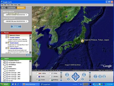
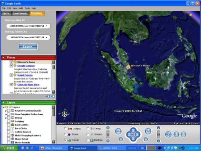
ok... the yellow pin marks where i am staying now in japan... hehe... nonono.. not at the imperial palace (i wish.. haha)
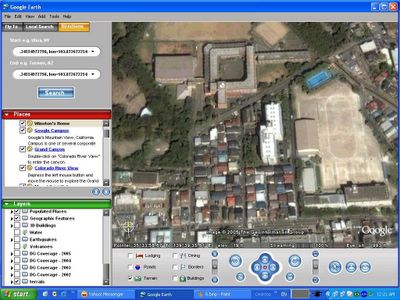
see the whitest building here? that's my dormitory.. cool hor? can see quite clear... (anyways, click on all images to see larger clearer photo)
among the 4 big buildings, the top left one is where i am at now - my workplace... hehe
cool hor?? wah sai... i wonder if can see pretty gals walking along shibuya or not??!!? no lah.. obviously not ;p
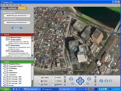
so how about singapore? hehe... let's see now...
redefining the "dot" that is in singapore... hehe again, the yellow pin marks the spot... ;)
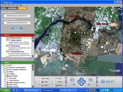
my house location in singapore (can i submit this pic for the 1-singapore-minute thingy? ;p)..
hehe.. prior to this, always thought serangoon was more to the west than the east.. well.. i was wrong...
hmmm... i hope i aint invading my family's privacy by showing where my house is... here it goes...
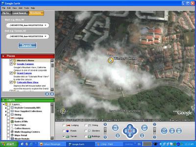
whew... my house is covered by the clouds.. hehe.. natural privacy screen from google's satellites - good eh?
well... for those who wanna download and play with this thing, you can get the basic one free here, or you can get a pro one that costs 400 bucks per year via *ahem*bit torrent*ahem*... ;p
have fun! ;)
posted by winz at 2:04 PM
~|=|~
|


4 Comments:
i tot this entry will never see the light :p
By Anonymous, at
4:11 PM
Anonymous, at
4:11 PM
oh... artificial is you ah? is natural you too?? ;)
By winz, at
4:45 PM
winz, at
4:45 PM
Haha... can't resist the urge to comment as artificial after seeing that u are quite "disturbed" by dear natural...
but trust me, natural is not artificial :p
By Anonymous, at
5:01 PM
Anonymous, at
5:01 PM
ok lor... since u say so..
By winz, at
5:03 PM
winz, at
5:03 PM
Post a Comment
<< Home